
“Borders may divide us, but, paradoxically, they're also the places where we're nearest to one another.”
-- Ken Jennings


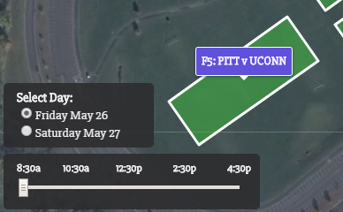
Dynamic, interactive ultimate frisbee field map made for event organizers, teams, fans, and media outlets.
The map was created using QGIS and Leaflet.
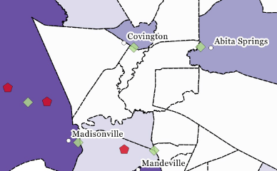
This quantitative thematic map of St. Tammany Parish in southeast Louisiana plots libraries per 5,000 people in an effort to identify potential "book deserts" in the region.
The map was created using QGIS.
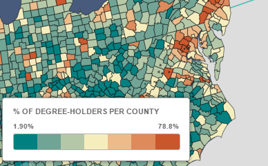
As of 2015, less than a third of American adults hold a Bachelor's Degree or better from colleges and universities. This map explores that data nationwide.
The map was created using Carto.
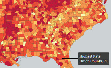
This quantitative thematic map of America displays cancer mortality rates by county for all races, genders, and ages.
The map was created using QGIS and Carto.
Thanks for visiting! This page was created using GitHub.
To connect, visit any of the links below.